Best Hikes in Tasmania: 8 Trails Worth the Effort
The Overland Track, Three Capes, Wineglass Bay, Cradle Mountain, Bay of Fires, Maria Island and kunanyi/Mount Wellington, plus planning and gear.
In this guide
- Introduction to Tasmania's Hiking Paradise
- The Iconic Overland Track: A World-Class Journey
- Three Capes Track: Coastal Majesty and Comfort
- Wineglass Bay & Hazards Beach Circuit: Iconic East Coast Beauty
- Cradle Mountain Day Hikes: Exploring a Pristine Wilderness
- Bay of Fires Eco-Walk: Beaches, Boulders, and Aboriginal Heritage
- Maria Island Walks: Wildlife, History, and Serenity
- Kunanyi/Mount Wellington Summit: Hobart's Backyard Adventure
- Essential Planning Tips for Your Tasmania Hiking Adventure
- What to Pack: My Essential Tasmania Hiking Gear List
- Responsible Hiking & Eco-Tourism in Tasmania
- Conclusion: Your Tasmanian Hiking Adventure
This guide is part of our Tasmania Travel Guide — start there for the island-wide overview, itineraries and costs.
Tasmania is one of those places that etches itself onto your soul. The crisp air and rugged, ancient landscapes promise adventure, and the island offers a deep dive into some of the purest wilderness on Earth. If you're dreaming of an unforgettable journey through ancient rainforests, along pristine coastlines, and up majestic peaks, then you've come to the right place. This Ultimate Guide: Best Tasmania Hikes 2025 is your comprehensive resource to plan an epic hiking adventure. It covers everything from multi-day treks like the iconic Overland Track to stunning day walks, complete with practical details, budget breakdowns, and pro tips to ensure your Tassie trek is nothing short of spectacular.
Introduction to Tasmania's Hiking Paradise
Tasmania, an island state off Australia's south coast, is a hiker's dream come true. With over 40% of its land protected as national parks and World Heritage Areas, it offers an unparalleled diversity of landscapes – from jagged alpine peaks and glacial lakes to ancient rainforests, wild coastlines, and pristine white-sand beaches. Raw, untamed beauty is remarkably accessible, even from the capital, Hobart, and every turn seems to reveal another breathtaking vista, another trail beckoning you deeper. The air is so clean it almost tastes sweet, and the silence, broken only by the call of a currawong or the rustle of a wallaby, is profound. This is a place where you can truly disconnect and immerse yourself in nature.
Why Tasmania is a Premier Hiking Destination
- Unesco World Heritage Wilderness: Home to the Tasmanian Wilderness World Heritage Area, recognized for its natural and cultural significance.
- Diverse Ecosystems: Experience everything from ancient Gondwanan rainforests to coastal heathlands.
- Well-Maintained Trails: Parks and Wildlife Service Tasmania does an incredible job maintaining trails for all fitness levels.
- Unique Wildlife: Spot endemic species like pademelons, wombats, and the elusive Tasmanian devil. It's truly a wildlife photographer's dream.
- Four Distinct Seasons: Offers different hiking experiences throughout the year, though summer (Dec-Feb) is peak season.
The Iconic Overland Track: A World-Class Journey
The Overland Track is a 65-kilometer (40-mile) journey through the heart of the Tasmanian Wilderness World Heritage Area and, without a doubt, one of the world's most renowned walks. Early March is a good time to tackle it, as the last of the summer crowds are thinning and the weather is still relatively stable. Starting at Cradle Mountain and ending at Lake St Clair, it’s a physical and mental challenge, but the rewards – unparalleled views, ancient forests, and a profound sense of accomplishment – are immeasurable.
Highlights include summiting Cradle Mountain (an optional side trip) on a clear morning, when the sun paints the jagged dolerite peaks in fiery hues, and the chance of spotting a platypus swimming in a tranquil creek.
Key Details and Planning for the Overland Track
- Length: 65 km (40 miles) main track, with numerous side trips adding significant distance.
- Duration: Typically 6 days / 5 nights. Allow extra days for side trips.
- Location: Starts at Cradle Mountain-Lake St Clair National Park (north end) and finishes at Cynthia Bay, Lake St Clair (south end).
- Accommodation: Huts are available for trekkers, but you MUST carry a tent as huts can fill up. Private tour operators also offer guided walks with comfortable hut accommodation.
- Permit: Essential! Book well in advance.
Pro Tip: Book your Overland Track permit as soon as possible – they sell out months in advance, especially for peak season (December-February). For 2025, booking typically opens in July 2024. Also, seriously consider the side trips like the climb up Cradle Mountain, the summit of Barn Bluff, and the trip to the top of Mount Ossa (Tasmania’s highest peak). They add effort but deliver incredible views!
Permits & Fees ( Estimates)
- Overland Track Fee (per person): AUD $312 (~USD $203) (subject to change, check PWS website). This permit is required during the booking season (October 1 - May 31).
- National Parks Pass: The track fee includes park entry for the duration of the walk during the booking season; outside it (June–September) a Tasmanian National Parks Pass is required.
- Holiday Pass (up to 2 months): AUD $98.35 (~USD $64) per vehicle (for up to 8 people).
- 24-hour Pass: AUD $49.15 (~USD $32) per vehicle.
- Annual Pass: AUD $104.75 (~USD $68).
Getting There & Shuttle Services
- Starting Point: Ronny Creek, Cradle Mountain.
- Address: Ronny Creek, Cradle Mountain-Lake St Clair National Park, Tasmania.
- Access: Shuttle bus from the Cradle Mountain Visitor Centre.
- Visitor Centre Address: 4057 Cradle Mountain Rd, Cradle Mountain TAS 7310.
- Shuttle Hours: Generally 8 AM - 6 PM (seasonal variations). Buses run frequently.
- Cost: Included in the Overland Track booking fee.
- Ending Point: Cynthia Bay, Lake St Clair.
- Address: Cynthia Bay, Lake St Clair, TAS 7140.
- Shuttle Services: Several private operators offer transport back to Cradle Mountain, Launceston, or Hobart. Book these well in advance.
- Tassielink Transit: Operates services on specific days.
- Jump Tours & Transfers: Private shuttle options.
- Cost: Expect to pay AUD $70-150 (~USD $47-100) depending on destination and operator.
Overland Track Budget Breakdown (Per Person, Self-Guided)
| Item | Estimated Cost (AUD) | Estimated Cost (USD) | Notes |
|---|---|---|---|
| Overland Track Permit | $312 | $203 | Mandatory during booking season |
| National Parks Pass | $0 | $0 | Park entry included in the track fee during the booking season |
| Food (6 days) | $100 - $150 | $67 - $100 | Dehydrated meals, trail snacks |
| Gas Canister | $15 - $25 | $10 - $17 | For cooking |
| Shuttle (Lake St Clair back) | $70 - $150 | $47 - $100 | Varies by destination (e.g., Launceston/Hobart) |
| Gear Hire (if needed) | $50 - $150 | $34 - $100 | Tent, sleeping bag, backpack (daily rates apply) |
| Total (Estimate) | $545 - $790+ | $355 - $515+ | Excluding flights to Tasmania, pre/post accommodation |
Three Capes Track: Coastal Majesty and Comfort
If the Overland Track is about rugged wilderness and self-sufficiency, the Three Capes Track is its more luxurious, coastal cousin. This 48-kilometre (30-mile), four-day, three-night experience on the Tasman Peninsula offers mind-blowing cliff-top views, beautifully designed huts, and a surprisingly comfortable way to immerse yourself in one of Australia's most dramatic coastal landscapes. The contrast with the Overland is striking: the creature comforts of the Three Capes (proper mattresses, gas cooktops, and even USB charging) feel like pure indulgence after a day of hiking. The sheer scale of the dolerite sea cliffs, plummeting hundreds of metres into the Southern Ocean, is absolutely awe-inspiring. Standing on Cape Pillar, with the wind whipping around you and the endless ocean stretching to the horizon, feels like standing on the edge of the world.
Key Details and Planning for the Three Capes Track
- Length: 48 km (30 miles).
- Duration: 4 days / 3 nights.
- Location: Tasman Peninsula, starting at Denmans Cove and finishing at Fortescue Bay.
- Accommodation: Exclusive to the track, guests stay in three architecturally designed huts (each night a different hut: Surveyors, Munro, Retakunna). You don't need to carry a tent or cooking equipment.
- Permit: Mandatory and all-inclusive (includes boat transfer, hut accommodation, and National Parks Pass). Book well in advance.
- Difficulty: Moderate – well-maintained undulating paths with some climbs. No significant river crossings or highly exposed sections.
Pro Tip: While the huts are excellent, they are communal. If you're a light sleeper, consider earplugs. Also, don't underestimate the sheer beauty of the side walks to the capes – Cape Hauy, Cape Pillar, and The Blade. Take your time, pack a day pack with water and snacks, and soak it all in. The views from The Blade are particularly thrilling!
Permits & Fees ( Estimates)
- Three Capes Track Package (per person): AUD $650 (~USD $423) (subject to change, check PWS website). This fee covers the boat transfer, hut accommodation, and National Parks Pass.
Getting There & Logistics
- Starting Point: Three Capes Track office, Port Arthur Historic Site.
- Address: 6973 Arthur Highway, Port Arthur TAS 7182.
- Check-in: You check in here, receive your track pass and gear tags, and attend a briefing.
- Boat Transfer: A wilderness cruise takes you from Port Arthur to Denmans Cove, the start of the walk.
- Departure Time: Specific time slots (e.g., 10:00 AM, 11:30 AM). Be there at least 30 minutes prior.
- Ending Point: Fortescue Bay.
- Address: Fortescue Bay Rd, Fortescue Bay TAS 7182 (gravel road).
- Shuttle Services: A shuttle bus (included in your package fee) will pick you up from Fortescue Bay and take you back to the Port Arthur Historic Site.
- Driving: Port Arthur is approximately 1.5 hours drive from Hobart. Free parking is available at the Visitor Centre for the duration of your walk.
Three Capes Track Budget Breakdown (Per Person)
| Item | Estimated Cost (AUD) | Estimated Cost (USD) | Notes |
|---|---|---|---|
| Three Capes Track Package | $650 | $423 | Includes permit, boat, huts, national park entry |
| Food (4 days) | $80 - $120 | $53 - $80 | Cook your own meals in the huts |
| Transport to/from Port Arthur | $0 (if driving) - $50 | $0 - $34 | E.g., one-way bus from Hobart to Port Arthur (~$25) |
| Total (Estimate) | $730 - $820 | $475 - $533 | Excluding flights to Tasmania, pre/post accommodation |
Wineglass Bay & Hazards Beach Circuit: Iconic East Coast Beauty
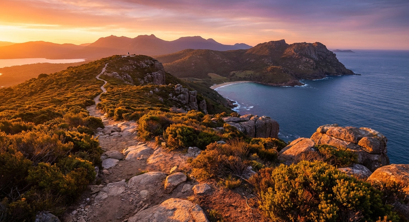
The view from the platform overlooking Wineglass Bay is unforgettable. That perfectly curved, white-sand beach meeting the turquoise waters, framed by the pink granite Hazards Mountains – it’s postcard perfection. While many people just do the short lookout walk, it's well worth doing the full 11 km (6.8 miles) circuit incorporating Hazards Beach. The contrast between the popular Wineglass Bay side and the solitary beauty of Hazards Beach is striking. Walking along Hazards Beach, with only the sound of the waves and the occasional seabird, can feel like having a private piece of paradise. It's a fantastic day hike if you're exploring the east coast.
Key Details and Planning for Wineglass Bay Circuit
- Length: 11 km (6.8 miles) circuit via Wineglass Bay Lookout, Wineglass Bay Beach, and Hazards Beach.
- Duration: 4-5 hours.
- Location: Freycinet National Park, East Coast Tasmania.
- Difficulty: Moderate – steep climb to the lookout, then undulating trails.
- Best Time: Year-round, but summer offers best swimming conditions. Avoid peak heat in the middle of the day during summer.
Pro Tip: Start early to avoid the crowds, especially at the lookout. Pack swimwear and a towel for a dip at Wineglass Bay (it’s a bit of a walk down from the lookout, but worth it!) or the calmer waters of Hazards Beach. Keep an eye out for wallabies and even white-bellied sea-eagles circling above the cliffs.
Entry & Fees
- National Parks Pass: Required for entry into Freycinet National Park.
- 24-hour National Parks Pass (per vehicle): AUD $49.15 (~USD $32)
- Holiday Pass (per vehicle, up to 2 months): AUD $98.35 (~USD $64) (if you plan to visit multiple parks)
Getting There
- Location: Freycinet National Park, Coles Bay.
- Parking: A large car park is available at the start of the track (Wineglass Bay Car Park).
- Address: Freycinet Dr, Coles Bay TAS 7215.
- Distance from Hobart: Approximately 2.5 hours drive.
- Distance from Launceston: Approximately 2 hours drive.
Wineglass Bay Circuit Budget Breakdown (Per Person)
| Item | Estimated Cost (AUD) | Estimated Cost (USD) | Notes |
|---|---|---|---|
| National Parks Pass Share | $10 - $40 | $7 - $27 | Depending on number of people in vehicle & pass type |
| Food & Snacks | $15 - $30 | $10 - $20 | Pack your own lunch and snacks |
| Total (Estimate) | $25 - $70+ | $17 - $47+ | Excluding transport to Freycinet/accommodation |
Cradle Mountain Day Hikes: Exploring a Pristine Wilderness
Even if you're not tackling the full Overland Track, Cradle Mountain-Lake St Clair National Park offers some of Australia's most spectacular day hikes. This is a truly iconic part of Tasmania. The landscape feels ancient and alive, with glacial lakes reflecting jagged peaks, and moss-covered rainforests giving way to open button grass plains. It's worth spending several days exploring different trails here, as each one offers a unique perspective. The Dove Lake Circuit is an absolute must-do, but don't stop there. The options abound for all fitness levels.
Popular Day Hikes at Cradle Mountain
- Dove Lake Circuit:
- Length: 6 km (3.7 miles) loop.
- Duration: 2-3 hours.
- Difficulty: Easy to Moderate – well-maintained path, part board-walked, passing through ancient rainforest and beaches.
- Highlights: Iconic views of Cradle Mountain, Glacial Rock, Ballroom Forest.
- Starting Point: Dove Lake car park (accessed via shuttle bus).
- Marion's Lookout:
- Length: Varies depending on starting point (e.g., from Dove Lake circuit: approx. 3-4 km return, but very steep).
- Duration: 2-3 hours return from Dove Lake carpark via Wombat Pool.
- Difficulty: Hard – very steep ascent in parts, with chain assists.
- Highlights: Unbeatable panoramic views of Dove Lake and Cradle Mountain. My knees protested, but the view was worth every ache!
- Starting Point: Can be accessed from Dove Lake Circuit or Ronny Creek.
- Overland Track Day Walks:
- Walk the first section of the Overland Track from Ronny Creek towards Waterfall Valley. You can turn back at Marions Lookout or even less distance, depending on your energy.
- Difficulty: Moderate to Hard, depending on how far you go.
- Highlights: Experience a taste of the Overland, spot wombats at Ronny Creek.
Pro Tip: Wombats are particularly active around Ronny Creek at dawn and dusk – get there early to catch them grazing! While Dove Lake Circuit is accessible to most, if you're up for a challenge and a truly rewarding view, Marion’s Lookout is epic. Just be prepared for a solid climb!
Entry & Fees
- National Parks Pass: Required for entry into Cradle Mountain-Lake St Clair National Park.
- Cradle Mountain Day (Icon) Pass: AUD $30.70 (~USD $20) per adult, including the shuttle bus; standard daily vehicle passes are not valid at Cradle Mountain.
- Holiday Pass (per vehicle, up to 2 months): AUD $98.35 (~USD $64); shuttle ticket extra.
Getting There & Park Transport
- Visitor Centre Address: 4057 Cradle Mountain Rd, Cradle Mountain TAS 7310.
- Access to trails: Most trails within the park are accessed via the shuttle bus from the Visitor Centre.
- Shuttle Hours: Generally 8:00 AM - 6:00 PM (seasonal variations, check upon arrival). Buses run frequently.
- Cost: Included with the Cradle Mountain Day (Icon) Pass and the Overland Track booking fee.
- Private Vehicles: Access to Dove Lake is generally restricted to the shuttle during most daylight hours. You might be able to drive in very early or late, but check current regulations.
- Distance from Launceston: Approximately 2 hours drive.
- Distance from Hobart: Approximately 4.5 hours drive.
Cradle Mountain Day Hikes Budget Breakdown (Per Person)
| Item | Estimated Cost (AUD) | Estimated Cost (USD) | Notes |
|---|---|---|---|
| National Parks Pass Share | $10 - $40 | $7 - $27 | Depending on number of people in vehicle & pass type |
| Food & Snacks | $15 - $30 | $10 - $20 | Pack your own lunch and snacks |
| Total (Estimate) | $25 - $70+ | $17 - $47+ | Excluding transport to Cradle Mountain/accommodation |
Bay of Fires Eco-Walk: Beaches, Boulders, and Aboriginal Heritage
The Bay of Fires is famous for its orange lichen-covered granite boulders, stretching for kilometers along pristine white-sand beaches with turquoise water. This isn't a single defined "track" in the traditional sense, but rather a series of interconnected walks, often done as guided multi-day 'eco-walks' that offer a blend of gentle hiking, beachfront strolls, and deep cultural immersion. Guided walks typically cover the Aboriginal history of the area and edible native plants, with sunrises over an empty, ancient coastline.
Key Details and Planning for Bay of Fires
- Length: Varies significantly. Guided walks are typically 3-4 days, covering 30-40 km. Day walks are possible along various sections.
- Duration: 1-4 days.
- Location: North-east coast of Tasmania, stretching from Binalong Bay to Eddystone Point.
- Difficulty: Easy to Moderate – mostly flat beach walking and coastal paths. Some short rocky sections.
- Accommodation (Guided Walks): Luxurious eco-lodges with all amenities.
Pro Tip: While you can explore sections of the Bay of Fires independently, the guided multi-day walks offer a richer experience, including private accommodation, gourmet food, and invaluable insights into the area's ecology and Aboriginal heritage. If doing it independently, choose your section and be aware of tide times for beach walking!
Fees & Guided Tour Costs
- Independent Exploration: No specific permit needed for most day walks, but you'll need transport.
- Guided Bay of Fires walks (3 or 5 days): Prices range significantly due to the luxury component. Expect AUD $2,295 - $3,550 (~USD $1,490 - $2,310) per person for all-inclusive guided tours with accommodation, meals, and transfers. (Always check current prices with operators like "Bay of Fires Lodge Walk").
Getting There
- Entry Points: Various access points along the coast, including Binalong Bay, St Helens, and Eddystone Point.
- Guided Tours: Typically include transfers from Launceston.
- Driving:
- Binalong Bay (southern end of Bay of Fires): Approximately 2.5 hours drive from Launceston, 3.5 hours from Hobart.
Maria Island Walks: Wildlife, History, and Serenity
Maria Island is a true gem – a national park where cars are banned, and wildlife roams freely. A visit here feels like stepping back in time. You can spend hours simply observing the wombats, Cape Barren geese, and even Tasmanian devils (though they are shy and harder to spot) going about their lives, unfazed by human presence. The Painted Cliffs and Fossil Cliffs are geological wonders, and the convict history at Darlington adds a poignant layer. It's an island that invites you to slow down, breathe deeply, and reconnect with nature. A mix of short walks and a longer hike to the summit of Bishop and Clerk is a good way to take in the island’s diverse offerings.
Key Details and Planning for Maria Island
- Length: Various walks from short strolls (1-2 km) to multi-day circuits (25-40 km). The walk to Bishop and Clerk is approx. 11 km return.
- Duration: Day trip to 3-4 days (for multi-day walks).
- Location: Off Tasmania's east coast, accessible by ferry from Triabunna.
- Difficulty: Easy to Hard, depending on chosen walk. The Bishop and Clerk summit has steep, rocky sections.
- Accommodation: Basic camping at Darlington or White Gums. Restored penitentiary dorms for basic shelter. Book ahead. Private guided walks also offer luxury accommodation.
Popular Walks on Maria Island
- Painted Cliffs & Fossil Cliffs:
- Length: 4.5 km return from Darlington.
- Duration: 2-3 hours (allowing for exploration).
- Difficulty: Easy, flat walks.
- Highlights: Unique geological formations, abundant wildlife.
- Note: Check tide times for Painted Cliffs access.
- Bishop and Clerk Walk:
- Length: 11 km (6.8 miles) return from Darlington.
- Duration: 4-5 hours.
- Difficulty: Hard – steep, rocky ascent in the final section. Not for those with vertigo.
- Highlights: Panoramic views of the Tasmanian coast and island, incredible rock formations. My legs burned, but the vista from the top was incredible!
Pro Tip: Maria Island is a car-free zone, so you'll be walking or cycling everywhere. The ferry has limited capacity, so book your return trip well in advance. And seriously, keep your distance from the wombats – they're incredibly cute but are wild animals!
Entry & Fees
- National Parks Pass: Required for entry onto Maria Island.
- 24-hour National Parks Pass (per vehicle, if you're parking in Triabunna): AUD $49.15 (~USD $32).
- Individual National Parks Pass (if no car): AUD $24.55 (~USD $16) per person.
- Ferry to Maria Island: Operated by Encounter Maria Island.
- Return Adult Fare: AUD $49 (~USD $33) (check current prices).
- Camping:
- Darlington Campground: AUD $7-13 (~USD $5-9) per person per night (check PWS website).
- Penitentiary Accommodation: AUD $20-25 (~USD $13-17) per person per night.
Getting There
- Ferry Departure: Triabunna.
- Ferry Terminal Address: 17 Esplanade, Triabunna TAS 7190.
- Distance from Hobart: Approximately 1 hour 15 minutes drive.
- Distance from Launceston: Approximately 2 hours 15 minutes drive.
- Parking: Free parking is available at Triabunna for ferry passengers.
- Ferry Schedule: Varies seasonally, typically 2-4 departures daily. Booking essential!
Kunanyi/Mount Wellington Summit: Hobart's Backyard Adventure
Whether you live in Hobart or are just passing through, it's impossible to ignore the majestic presence of Kunanyi/Mount Wellington. Towering over the city, its ever-changing summit weather is a constant talking point. The mountain can be hiked by different routes, and each ascent offers a fresh perspective of the city, coastline, and inland wilderness. The South Summit track is a memorable choice at sunset, when long shadows stretch over the Derwent River before the city lights twinkle below. It's easily accessible and offers an incredible payoff for relatively little effort. A perfect hike to stretch your legs after a long flight or before enjoying Hobart's culinary delights.
Key Details and Planning for Kunanyi/Mount Wellington
- Length: Various walks. Approximately 3-4 km return from the Springs to the Summit (via Pinnacle Track).
- Duration: 1-4 hours, depending on starting point and route. Drive to the summit for views takes 30 mins from Hobart.
- Location: Directly west of Hobart.
- Difficulty: Easy to Moderate – a mix of well-graded paths and some steeper sections.
Popular Walks on Kunanyi/Mount Wellington
- Pinnacle Track (from The Springs):
- Length: 4 km return.
- Duration: 2-3 hours.
- Difficulty: Moderate – steady uphill climb on a well-formed track.
- Highlights: Offers excellent views looking back towards Hobart as you ascend.
- Organ Pipes Walk:
- Length: 5 km return (from The Springs).
- Duration: 2.5-3.5 hours.
- Difficulty: Moderate – relatively flat until you reach the base of the impressive dolerite columns.
- Highlights: Dramatic rock formations, different perspective of the mountain.
- Zig Zag Track:
- Length: 5.5 km return (from Big Bend).
- Duration: 2-3 hours.
- Difficulty: Moderate – a more gradual ascent to the summit.
Pro Tip: The weather on Kunanyi summit can change in an instant, even on a sunny day in Hobart. Pack layers, including a warm jacket, beanie, and gloves, regardless of the forecast! There's often snow up there even in late spring. Always check conditions before heading up.
Entry & Fees
- No Entry Fee: Access to Kunanyi/Mount Wellington is free.
Getting There
- Driving: Approximately 30 minutes drive from central Hobart to the summit via Pinnacle Road.
- Public Transport: The "Kunanyi/Mount Wellington Explorer Bus" offers scheduled services from Hobart CBD to the summit, with hop-on/hop-off options at various trailheads.
- Cost: AUD $35-45 (~USD $23-30) return (check current prices).
- Departure Points: Various stops in Hobart CBD.
- Cycling: A challenging but rewarding ride up (and exhilarating down!).
Essential Planning Tips for Your Tasmania Hiking Adventure
Tasmania’s wilderness is stunning, but it demands respect and preparation. Here are some non-negotiable planning tips to ensure a safe and enjoyable hike.
1. Best Time to Hike
- Summer (December - February): Peak season. Warmest weather (15-25°C / 59-77°F), longest daylight hours. Best for multi-day treks. Book everything well in advance!
- Autumn (March - May): A great time to go! Mellower weather (10-20°C / 50-68°F), fewer crowds, stunning Fagus (deciduous beech) colours in alpine areas.
- Spring (September - November): Wildflowers, often changeable weather (8-18°C / 46-64°F), can still get cold and wet. Great for coastal walks.
- Winter (June - August): Cold, wet, potential snow in alpine areas (0-10°C / 32-50°F). Suited for experienced hikers with appropriate gear. Shorter daylight hours. Some tracks may be closed.
2. Permits and Bookings
- National Parks Pass: Essential for entry into all national parks. Buy online or at Visitor Centres.
- Track Permits: The Overland Track and Three Capes Track require specific permits, booked MONTHS in advance. Do not underestimate this!
- Accommodation: Book huts, camping sites, or any pre/post trek accommodation far in advance, especially during peak season.
3. Navigating Tasmania
- Rental Car: Highly recommended for flexibility, especially for day hikes. Book well in advance. Expect to pay AUD $50-100+ (~USD $34-67+) per day for a standard car, excluding fuel.
- Shuttles/Buses: Services exist for popular tracks (e.g., Cradle Mountain shuttle, Three Capes transfer, Overland Track transfers), but they often need prior booking.
- Driving Conditions: Roads can be winding and narrow. Watch out for wildlife, especially at dawn and dusk. Mobile reception is limited in many wilderness areas.
4. Weather Preparedness
- "Four seasons in one day" is not an exaggeration in Tasmania. Always pack layers.
- Check Bureau of Meteorology (BOM) for accurate forecasts.
Common Mistakes to Avoid
| Mistake | Why it's a mistake | How to avoid it |
|---|---|---|
| Underestimating weather | Even summer can bring snow, wind, and rain, leading to hypothermia risks. | Pack layers, waterproofs, gloves, beanie, even in summer. Check BOM forecast. |
| Not booking permits/accommodation early | Popular tracks and accommodation sell out months in advance. | Book Overland/Three Capes permits 6-12 months out. Book other accommodation 3-6 months. |
| Lack of fitness/preparation | Some tracks are genuinely challenging, leading to injury or not completing the walk. | Train with similar terrain/pack weight. Do shorter, challenging hikes beforehand. |
| Not carrying enough water & food | Beyond huts, water sources aren't always guaranteed or potable. Food means energy. | Always carry more water than you think you need. Carry emergency food. |
| Ignoring wildlife safety | Getting too close can stress animals or lead to bites/scratches. | Observe from a distance. Do NOT feed wildlife. Secure food from possums/quolls. |
| Relying solely on phone for navigation | Limited signal, battery drain, device failure. | Carry a physical map and compass (and know how to use them!) AND a fully charged power bank. |
What to Pack: My Essential Tasmania Hiking Gear List
An efficient packing list will prepare you for almost anything. Tasmania requires solid gear, even for day walks.
Essential Multi-Day Pack List (Overland Track example)
- Backpack: 60-75L for multi-day, 25-35L for day hikes. (My Osprey Aether 65L is a loyal companion.)
- Shelter: Lightweight 3-season tent (if not in huts).
- Sleeping Bag: Rated to 0°C (32°F) or lower, even in summer.
- Sleeping Mat: Insulated.
- Cooking Gear: Lightweight stove, fuel canister, pot, mug, spork.
- Water Bottles/Reservoir: At least 2L capacity. Water filter/purification tablets.
- Navigation: Topo map, compass, GPS device/app (with downloaded offline maps), power bank.
- First Aid Kit: Comprehensive, including blister treatment.
- Headlamp: With spare batteries.
- Sun Protection: Hat, sunglasses, sunscreen (even on cloudy days!).
- Toiletries: Small, biodegradable toiletries. Trowel, toilet paper, rubbish bags for waste.
- Small towel: Quick-drying.
- Rubbish Bag: Leave no trace!
- Camera: With spare battery and memory card, of course!
Clothing (Layers are Key!)
- Base Layers: Merino wool or synthetic (top and bottom).
- Mid-Layer: Fleece or puffy jacket.
- Outer Layer: Waterproof and windproof shell jacket and pants.
- Hiking Pants/Shorts: Quick-drying.
- Hiking Socks: Merino wool for comfort and blister prevention.
- Boots: Broken-in, waterproof hiking boots with good ankle support.
- Camp Shoes: Lightweight sandals or crocs for hut nights.
- Hat, Gloves/Beanie: Essential for cold weather and exposed areas.
Responsible Hiking & Eco-Tourism in Tasmania
Tasmania’s wilderness is precious and fragile. As hikers, we have a responsibility to minimize our impact and ensure these landscapes remain pristine for future generations. My mantra developed over years of travel is always "leave it better than you found it."
- Stick to Marked Trails: Helps prevent erosion and protects fragile flora.
- Leave No Trace: Pack out everything you pack in, including ALL food scraps and toilet paper. Bury human waste properly (20cm deep, 100m from water sources) or use designated toilets.
- Respect Wildlife: Observe from a distance. Never feed animals – it habituates them and can make them sick.
- Protect Water Sources: Don't wash yourself or dishes directly in streams or lakes.
- Minimise Fire Risk: Follow all fire bans. Use fuel stoves rather than campfires where possible, especially in high-risk periods.
- Be Prepared and Self-Sufficient: Reduces the need for emergency services and prevents damage from getting lost or stranded.
- Support Local: Choose local businesses, guides, and accommodation providers.
Conclusion: Your Tasmanian Hiking Adventure
From the rugged grandeur of the Overland Track to the serene historical trails of Maria Island, and the breathtaking coastal drama of the Three Capes, Tasmania offers a hiking adventure for every soul. The sheer untouched beauty and diverse ecosystems of Tassie keep drawing hikers back. It’s a place where you can challenge yourself physically, reconnect with nature on a profound level, and create memories that will truly last a lifetime.
So, whether you're planning an epic multi-day trek in 2025 or simply looking for striking day walks, this guide should help you prepare for your journey. Tasmania’s wild heart is calling, and it’s a call worth answering. Pack your bags, lace up your boots, and prepare for an unforgettable adventure!
More Tasmania guides
Tasmania Travel Guide: Plan the Perfect Trip
Getting to and around Tasmania, when to go, top sights, 5-day to 2-week itineraries, where to stay, food and wine, road-trip advice and…
Launceston Travel Guide: Things to Do in Two Days
How to spend two days in Launceston: Cataract Gorge, the Tamar Valley cellar doors, City Park and the best cafes and pubs in town.

Hobart Travel Guide: Where to Eat, Stay and Explore
Three days in Hobart done properly: Salamanca Market, MONA, kunanyi/Mount Wellington, the best places to eat and where to base yourself.