Things to Do in Costa Rica: Volcanoes and Coastlines
Costa Rica's volcanoes, cloud forests, rainforest wildlife, Pacific and Caribbean coasts, river rafting and coffee country, with route-planning advice.
In this guide
- Quick Facts for Travelling in Costa Rica
- Volcanoes and Geothermal Wonders of the Interior
- Cloud Forests and High Canopy Adventures
- Wildlife Wilderness and Rainforest Expeditions
- Exploring Two Coastlines: Pacific Surf and Caribbean Rhythms
- River Rafting, Highland Coffee, and Living Pura Vida
- Practical Travel Logistics and Route Planning
- Putting Your Costa Rica Route Together
This guide is part of our Costa Rica Travel Guide — start there for the overview, when to go and how to get around.
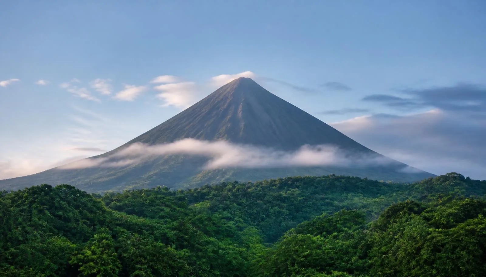
At five in the morning near Arenal, the humidity is thick enough to leave a slick coat of moisture across a camera body before the lens bag is even unzipped. When the grey cloud peels back from the upper slopes, it reveals the dark, symmetrical cone of the volcano, while scarlet macaws cut through the canopy with harsh, echoing calls. Add an afternoon soaking trail-weary legs in a naturally heated river winding through dense tree ferns, and it's easy to see why travelers spend decades returning to this narrow Central American bridge between two oceans.
Costa Rica sits jammed between the Pacific Ocean and the Caribbean Sea, compressed into a landmass roughly three-quarters the size of Tasmania. Despite its compact footprint, the country contains around five percent of the planet's known biodiversity, carved into distinct microclimates by a central spine of volcanic mountain ranges. Within a single day's drive, you can move from sun-baked Pacific surf breaks through dripping high-altitude cloud forests and down to murky, mangrove-fringed Caribbean waterways.
Navigating this terrain requires an understanding of how geography, altitude, and weather interact. Roads can turn from smooth tarmac to boulder-strewn dirt tracks within a single kilometre, and the shift from dry season to wet season completely alters how you move through the country. This guide breaks down the core regions, ecosystems, and active adventures across Costa Rica, along its dirt roads and river networks.
Quick Facts for Travelling in Costa Rica
- Capital: San José (Central Valley)
- Geography: Central American country bordered by Nicaragua to the north, Panama to the south, the Pacific Ocean to the west, and the Caribbean Sea to the east.
- Key Regions: Northern Highlands (Arenal & Monteverde), Guanacaste & Nicoya Peninsula, Central Pacific, South Pacific (Osa Peninsula), Caribbean Coast, and Central Valley.
- Climate: Tropical with two main seasons—Dry Season (December to April) and Green Season (May to November). Local microclimates vary heavily by elevation and slope.
- Language: Spanish; English is widely spoken in primary tourism hubs.
- Currency: Costa Rican Colón (CRC), though United States Dollars are broadly accepted for tourism services.
- Transport: Domestic flights, public buses, shared minivans, and rental vehicles (a four-wheel drive is highly recommended for rural and coastal roads).
Volcanoes and Geothermal Wonders of the Interior
The geological backbone of Costa Rica is defined by its mountain ranges, shaped by intense tectonic activity. Active and dormant craters dot the interior highlands, creating dramatic topography, mineral-rich soils, and widespread geothermal activity. Visiting these volcanic zones provides an immediate sense of the forces that continue to shape the landscape.
Arenal Volcano and the Hot Springs of La Fortuna
Arenal is perhaps Costa Rica’s most recognizable landmark. Rising perfectly above the northern plains near the town of La Fortuna, this stratovolcano experienced a major eruption in 1968 and remained highly active until 2010. While it currently sits in a resting phase without visible lava flows, steam frequently vents from its peak, and the surrounding terrain remains deeply affected by its thermal footprint.
Hiking trails around the base of Arenal, particularly within the national park and nearby private reserves, wind through secondary rainforest growing over historic lava fields. Walking across the dark, jagged basaltic rock from older eruptions gives a stark view of natural regeneration; pioneer plant species cling to the volcanic crust while giant ficus trees tower nearby. The elevation is low enough to keep temperatures warm and humid, making early morning hikes essential before heat and afternoon cloud cover set in.
The true reward after exploring the rough lava fields lies in the river systems fed by the volcano's geothermal core. Water trickles down from the subterranean heat sources, emerging as warm, mineral-rich rivers flowing through the forest. Facilities along these thermal streams range from completely undeveloped natural riverbanks accessed via roadside paths to elaborate landscaped thermal gardens with cascading pools of varying temperatures. The water absorbs minerals like silica, calcium, and magnesium as it circulates underground, offering genuine relief for muscles spent trudging over volcanic rock.
Rincón de la Vieja National Park
Located in the northwestern province of Guanacaste, Rincón de la Vieja offers a starkly different volcanic landscape. This massive complex volcano features multiple craters and crater lakes, surrounded by a dry tropical forest ecosystem that contrasts sharply with the wet forests of Arenal.
The Las Pailas sector of the national park serves as a showcase for subterranean volcanic power. A loop trail leads hikers past bubbling mud pots, steaming fumaroles venting sulfurous gases, and scalding hot springs discharging directly into river channels. The scent of sulfur hangs heavy in the air, and the ground hums with low-level activity. Because Guanacaste experiences a pronounced dry season, the forest surrounding the volcanic vents drops its leaves during early months of the year, providing clear sightlines for spotting toucans, white-faced capuchin monkeys, and blue-crowned motmots taking refuge near watercourses.
Poás and Irazú Craters
For those basing themselves in or near San José, the high-altitude volcanic craters of Poás and Irazú offer accessible daylight excursions into the cool central highlands. Both volcanoes feature vast, active craters containing acidic crater lakes that shift in colour depending on rainfall and mineral concentration.
- Poás Volcano: Home to one of the largest open craters in the world. At over 2,600 metres above sea level, the crater floor contains a steaming, turquoise acid lake that periodically exhibits minor phreatic eruptions. The surrounding stunted cloud forest is often draped in cold mist, requiring warm layers and rain gear. Because clouds accumulate rapidly, viewing the crater requires arriving early in the morning before mist fills the bowl. Access depends on volcanic activity: the park closed for several months in 2025 and reopened with capped visitor numbers, timed crater-viewing slots, compulsory helmets and online-only tickets via SINAC.
- Irazú Volcano: Standing as the highest active volcano in Costa Rica at over 3,400 metres, Irazú presents a stark, almost lunar landscape near its summit. The main crater plunges down to a mineral lake that can range from vivid green to deep grey. On rare, crystal-clear mornings, it is possible to stand on the high summit ridges and view both the Pacific Ocean and the Caribbean Sea simultaneously.
Río Celeste and Tenorio Volcano
Nestled within Tenorio Volcano National Park, the Río Celeste is famous for its stunning, milky-turquoise hue. This unusual colour is not caused by algae or dyes, but rather by a physical phenomenon called Mie scattering. Where two clear tributaries—the Río Buenavista and Quebrada Agria—meet at a precise spot called El Teñidero, the sudden drop in pH causes aluminosilicate particles suspended in the water to expand and scatter sunlight, producing an intense sky-blue appearance.
The trail leading through the park follows the river up through dense, wet forest to a roaring waterfall that plunges into a turquoise basin. Further along, the path passes bubbling geothermal vents along the riverbed and boardwalks crossing muddy rainforest terrain. Hikers should be prepared for thick, slippery mud during the green season, as well as strict conservation rules that prohibit swimming inside the national park boundaries to protect the delicate aquatic chemistry.
Cloud Forests and High Canopy Adventures
While lowland rainforests are defined by high heat and towering trees, cloud forests occupy high-elevation ridgelines where atmospheric humidity hovers at 100 percent. Moisture-laden wind blowing off the oceans hits the steep mountain slopes, rising, cooling, and condensing into a perpetual mantle of fog and light drizzle. This constant moisture fosters incredible botanical diversity.
Monteverde Cloud Forest Reserve
Perched along the Continental Divide in the Tilarán mountain range, Monteverde is one of the world's premier tropical cloud forest sanctuaries. The atmosphere here is atmospheric and quiet, muffled by thick curtains of green vegetation. Trees are so heavily coated in epiphytes—mosses, orchids, bromeliads, and ferns—that the true bark of the host trunks is rarely visible.
Walking through the Monteverde Cloud Forest Reserve or the adjacent Santa Elena Reserve feels like stepping into a cold, wet green cathedral. Water constantly drips from the upper canopy, even when heavy rain isn't actively falling. The cool temperatures make for crisp, invigorating hiking conditions, though sturdy waterproof boots and protective covers for camera gear are absolute necessities. The ecosystem acts like a massive sponge, capturing water from passing clouds and distributing it slowly to the lowlands via dozens of mountain streams.
Hanging Bridges and Canopy Access
To fully grasp the structure of a cloud forest, you need to get off the forest floor. A vast proportion of the biological activity in a cloud forest occurs in the upper canopy, tens of metres above the soil, where sunlight is most accessible. Hanging bridge networks suspended between giant trees or mountain ravines provide a stable platform for viewing this suspended aerial world.
From these elevated walkways, you look directly across into the crowns of massive oaks and tree ferns. Epiphytic gardens bloom at eye level, providing habitat for tree frogs, insects, and hummingbirds. Walking slowly across a suspension bridge swaying gently above a deep green valley offers a perspective on rainforest architecture that is completely impossible from ground level.
Zip-Lining across Mountain Valleys
Costa Rica pioneered modern recreational zip-lining, converting canopy research equipment into one of the country's signature adventure activities. The deep ravines and high forest cover surrounding Monteverde and Arenal provide dramatic terrain for these systems.
Secured into a harness and attached to steel cables, riders glide high above the forest canopy, moving between platforms built onto mountainsides or massive trees. Long cables can span over a kilometre, carrying riders across open valleys with cloud forest canopy sweeping below. It is a thrilling way to experience the scale of Costa Rica's mountainous topography, though wildlife spotting is secondary to the sheer adrenaline of the flight.
Wildlife Wilderness and Rainforest Expeditions
For naturalists and photographers, Costa Rica offers extraordinary density and diversity of animal life. The country serves as a biological bridge between North and South America, allowing species from both continents to overlap within complex protected ecosystems.
Corcovado National Park and the Osa Peninsula
Occupying the remote southwestern corner of the country, the Osa Peninsula shelters what National Geographic famously termed "the most biologically intense place on Earth." At its heart lies Corcovado National Park, protecting the largest remnant of Pacific lowland primary rainforest in Central America.
Reaching Corcovado requires effort. Visitors generally travel by boat from Sierpe through dense mangrove channels or fly into small coastal airstrips before taking boat transfers to ranger stations like Sirena or San Pedrillo. There are no roads through the interior of the park, meaning all exploration is done on foot alongside mandatory certified natural guides.
The wilderness experience here is raw and unvarnished. Standard sightings around Sirena Station include all four of Costa Rica's native monkey species (howler, spider, capuchin, and squirrel monkeys), tapirs resting near coastal streams, collared peccaries, and elusive apex predators like pumas and jaguars, whose tracks are frequently spotted in the damp sand along wild ocean beaches. Hiking through Corcovado involves negotiating high temperatures, extreme humidity, tidal river crossings, and dense, unyielding jungle.
Tortuguero Canals and Sea Turtle Nesting
On the opposite side of the country, along the northern Caribbean coast, lies Tortuguero National Park. Known as the "Costa Rican Amazon," Tortuguero is a network of natural lagoons, freshwater canals, and coastal swamps isolated from the road network. Access is exclusively by boat or light aircraft.
Exploration in Tortuguero takes place primarily on water. Flat-bottomed electric or paddle boats glide silently down narrow forest channels where the forest canopy stretches out from both banks. From the water, sharp-eyed visitors can spot caimans resting on submerged logs, river otters, basilisk lizards running across the surface, and dozens of waterbird species, including boat-billed herons and green ibises.
The wide, dark-sand ocean beaches of Tortuguero are globally critical nesting grounds for sea turtles. Between July and October, thousands of green sea turtles emerge from the pounding Atlantic surf under cover of night to dig pits and lay eggs in the sand. Leatherback turtles also nest here in smaller numbers earlier in the year. Guided night walks along restricted sections of the beach allow visitors to observe this ancient nesting ritual under strict light and conservation controls.
Manuel Antonio National Park
Located on the central Pacific coast, Manuel Antonio is one of Costa Rica’s smallest national parks, yet it remains one of its most visited. Its accessibility, well-maintained trails, and striking combination of lush rainforest dropping directly onto white sand beaches make it immensely popular.
Because animal life here has grown accustomed to human presence, wildlife viewing is nearly guaranteed. Sloths, capuchin monkeys, raccoons, and iguanas are frequently seen along the main forest loop trails. The park opens directly onto idyllic, sheltered coves where rainforest trees hang over warm Pacific waters. To manage visitor density and preserve the park's fragile habitats, daily entrance quotas are strictly enforced, requiring advance online ticket purchases (through SINAC) and morning arrival times. The park is closed every Tuesday.
Key Species and Where to Find Them
Understanding where and how to look for key wildlife species will significantly improve your sightings on trail:
- Sloths: Costa Rica is home to both two-toed and three-toed sloths. Three-toed sloths are active primarily during the day and are commonly seen hanging in cecropia trees throughout Manuel Antonio, Tortuguero, and La Fortuna. Two-toed sloths are nocturnal and tend to curl up high in leafy branch forks during daylight hours.
- Resplendent Quetzal: Famous for its vivid emerald plumage, ruby chest, and long, trailing tail feathers in males, the quetzal lives in high-altitude cloud forests. The best locations to spot them are the Savegre River Valley (San Gerardo de Dota) and the Monteverde reserves, particularly during their breeding season between March and May when avocado trees drop fruit.
- Scarlet Macaws: These large, brilliantly coloured parrots travel in pairs or small noisy flocks. They are abundant along the Pacific coast, particularly around Carara National Park and the Osa Peninsula, where they feed heavily on almond trees near the beach.
- Sea Turtles: In addition to Tortuguero's green turtles, Olive Ridley turtles gather in mass nesting events (called arribadas) at Ostional National Wildlife Refuge on the Nicoya Peninsula between August and November.
Exploring Two Coastlines: Pacific Surf and Caribbean Rhythms
Costa Rica’s two ocean fronts present fundamentally different geographical features, water conditions, and coastal cultures. The Pacific coast is vast, indented by deep gulfs and rugged peninsulas, while the Caribbean coast is shorter, flatter, and heavily influenced by Afro-Caribbean traditions.
The Pacific Coast: Surfing and Coastal Towns
The Pacific shoreline catches consistent ocean swells generated in both the northern and southern hemispheres, making it a year-round destination for surfers of all abilities.
- Tamarindo and Guanacaste: Tamarindo is a bustling coastal hub with an established tourism infrastructure, broad beaches, and reliable beach breaks ideal for learning to surf. The surrounding Guanacaste coastline features famous wave spots like Playa Grande, Playa Avellanas, and Witch’s Rock (inside Santa Rosa National Park).
- Santa Teresa and Mal País: Situated at the tip of the Nicoya Peninsula, Santa Teresa has transformed from a quiet fishing village into a trendy surf enclave. Accessible via unpaved roads or ferry crossings, its long stretches of open sand deliver powerful beach breaks backed by dense palm groves and yoga retreats.
- Nosara: Known for its protected coastal zone where building development is set back from the sand line, Nosara offers long, gentle beach breaks at Playa Guiones that cater to longboarders and intermediate surfers seeking a tranquil environment.
- Pavones: Located far in the south near the Panamanian border, Pavones is legendary among advanced surfers for harboring one of the longest left-hand point breaks in the world. When a solid south swell arrives, a single wave can be ridden for over a kilometre along the cobbled shoreline.
The Caribbean Coast: Cahuita, Puerto Viejo, and Afro-Caribbean Culture
Crossing over the Continental Divide to the Caribbean province of Limón brings an immediate shift in atmosphere. The climate is warm, wet, and humid year-round, without the dry season found on the Pacific side. The region boasts a rich cultural history, shaped heavily by Jamaican immigrants who arrived in the late 19th century to construct the national transcontinental railroad and work on banana plantations.
The southern Caribbean strip, extending from the port city of Limón down to the border post of Sixaola, revolves around the relaxed towns of Cahuita and Puerto Viejo de Talamanca. English-based Creole is spoken alongside Spanish, and the scent of coconut oil, ginger, and pan bon fills the air. Local eateries serve traditional Caribbean dishes like rice and beans cooked in coconut milk with habanero peppers, fresh red snapper, and slow-braised chicken.
Cahuita National Park features a stunning coastal trail running alongside broad white-sand beaches and living coral reefs. Offshore, the protected reef offers some of Costa Rica's best snorkeling when sea conditions are calm. Further south, Puerto Viejo offers a mix of legendary surf breaks (such as the powerful Salsa Brava reef break), black-sand beaches, and easy access to the Gandoca-Manzanillo Wildlife Refuge.
River Rafting, Highland Coffee, and Living Pura Vida
Beyond beaches and nature reserves, Costa Rica’s interior river valleys and highland agricultural zones provide opportunities for active river running and cultural exploration.
Whitewater Rafting on the Pacuare River
The Pacuare River, dropping out of the Cordillera de Talamanca down to the Caribbean slope, is universally ranked among the world's finest whitewater rafting trips. The river carves through a deep, undeveloped rainforest gorge draped in waterfalls and dense foliage.
Rafting itineraries on the Pacuare range from intense single-day runs to multi-day wilderness expeditions. The water conditions present Class III and Class IV rapids with names like "Huacas Upper and Lower" and "Cialitos." Between technical rapid sections, the river glides through quiet canyons where morpho butterflies flutter over the water and pristine waterfalls plunge hundreds of metres down shear rock faces straight into the main channel.
Coffee Culture in the Central Valley
Coffee has played a fundamental role in Costa Rica's economic and political history since the early 19th century, earning the nickname el grano de oro (the golden grain). High altitudes, cool nights, rich volcanic soils, and distinct rainy seasons create perfect growing conditions for high-quality Arabica coffee beans across the Central Valley, Tarrazú, and the slopes of Poás and Irazú volcanoes.
Visiting a working coffee farm allows you to trace the production process from plant to cup. During the harvest season between November and February, pickers hand-select bright red coffee cherries from steep hillsides. Farm tours demonstrate the wet-milling process, pulp removal, sun-drying on open concrete patios (or mechanical dryers), roasting, and cupping. Sampling fresh single-origin coffee directly at the farm source highlights nuances in acidity, body, and flavor profile influenced by microclimate elevation.
Understanding the "Pura Vida" Philosophy
You cannot spend more than an hour in Costa Rica without hearing the phrase Pura Vida (literally translated as "pure life"). More than just a friendly greeting or farewell, it functions as an overarching philosophy of optimism, gratitude, and unhurried living.
The phrase reflects a societal priority on community, relaxation, and peaceful coexistence. It explains why life moves at a measured pace, why locals are quick to assist stranded drivers on rural tracks, and why environmental conservation is prioritized over rapid industrial development. Embracing this mindset is essential for travellers when facing flight delays, muddy roads, or unhurried restaurant service; taking a breath and responding with a smile is the true Costa Rican way.
Practical Travel Logistics and Route Planning
Executing a smooth trip across Costa Rica requires realistic timing, sensible gear selection, and respect for local driving conditions.
Seasons and Weather Considerations
Costa Rica does not experience four traditional seasons. Instead, weather patterns are broken into two primary phases:
- Dry Season (December to April): Characterised by consistent sunshine, higher temperatures, and low rainfall along the Pacific coast and Central Valley. Roads are clear, though popular destinations experience high visitor numbers and higher accommodation rates.
- Green Season (May to November): Morning hours are typically clear and sunny, followed by heavy afternoon downpours and atmospheric storms. The landscape becomes brilliantly green, wildlife is active, and tourist crowds thin out. September and October are typically the wettest months on the Pacific side, though ironically, these same months often deliver clear, dry weather along the Caribbean coast.
Driving and Internal Transport
Renting a vehicle offers ultimate flexibility for reaching remote trailheads and coastal breaks, but driving requires caution. Primary highways are generally paved and well-maintained, but secondary roads leading to spots like Monteverde, Drake Bay, or the Nicoya Peninsula are frequently unpaved, pitted with potholes, and require crossing shallow riverbeds.
If renting a vehicle, choosing a true four-wheel drive with high ground clearance is strongly recommended for rural travel, particularly during the green season. GPS navigation apps work well, but travel times are almost always longer than distance suggests; covering 100 kilometres can easily take three to four hours in mountainous or unpaved terrain. Alternative options include scheduled shared shuttles between major hubs, domestic internal flights for long distances, or the extensive public bus network operating out of San José.
Putting Your Costa Rica Route Together
Timing shapes every Costa Rica itinerary. The dry season (December to April) brings reliable sunshine along with bigger crowds and higher rates, while the green season (May to November) offers clear mornings, afternoon downpours and quieter parks. In September and October, the Caribbean coast is often drier than the Pacific side.
Build in more travel time than the map suggests, since 100 kilometres can take three to four hours on mountain or unpaved roads. Hire a true four-wheel drive for rural routes, or use shuttles, buses and domestic flights instead. Buy Manuel Antonio tickets ahead and arrive in the morning, start volcano visits early before cloud rolls in, and remember Corcovado requires a certified guide.
More Costa Rica guides
10-Day Costa Rica Itinerary: Volcanoes, Forest, Coast
A Costa Rica itinerary built around Arenal, Monteverde and the coast — dry versus green season, wildlife, driving times and honest daily…

Best Beaches in Costa Rica: Pacific and Caribbean
Costa Rica's beaches coast by coast, from Guanacaste and Nicoya to the Osa Peninsula and the Caribbean, with advice on rip currents and…